RobbHaas Family Pages
Foulke - Haas - Robbins - Worthen  Families

  Salem Township
Delaware County, Indiana

Home Places Index Delaware County, Indiana   Sources Images
Schools Cemeteries Township Sections    

Salem Township Section Layout
36 31 32 33 34 35 36
1 6 5 4 3 2 1
12 7 8 9 10 11 12
13 18 17 16 15 14 13
24 19 20 21 22 23 24

Daleville:  Sections 1, 6, 7, 12

Towns:   Crossroads   -   Daleville   -   Progress   -   Richwoods P.O.   -   Summitsport   -   Tabor   -  
Location
Coordinates:  40°07′01″N
85°30′33″W  [
S2] -

Southwest corner of Delaware County - 22,400 acres - 7 miles long, 5 miles wide [S14, p 282]

Other Names
Population:
1850:   843 [S14, p 287]
1860:  1286 [S14, p 287]
1870: 1413  [S14, p 287]
1880: 1592 [S3, page 3]
Maps:
1838 Plat Map:  [S15, PDF page 3]
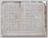
Before 1839I2,
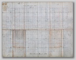
1863I3,
1870:  [S5] -
1874:  [S13, page 16] - Daleville -
1876 Delaware County  [S4] -
Cemeteries [S2] -
Saunders:  W CR500S - (Coordinates:  40.12151, -85.53192)
Sharp
Sunderland:  (Coordinates:  40.12006, -85.47106) - [S1] - [S9] -
Tomlinson:  (Coordinates:  40.14570, -85.43310) - [S1] - [S9] -
Unnamed:  (Coordinates:  40.14458, -85.45226)  - [S1] - [S9] -

Daleville Link

1874:  Sec. 36 (East) - Sec 5 - [S13, page 16] -

"Pinch-Penny was a township center in the days of the toll gates.  It was located at the present site of Fort's Filling Station, and boasted of a toll-gate, grocery, and blacksmith shop.  (Originally appeared in "Daleville Centennial News", 15 Nov 1938)  [S6]
1960 Plat map of Salem Township  [S7] -
Mill Race ?? - An interesting feature just east of the intersection of CR400S and CR900W - CR400S tees into CR900W at this point - [S3] - [S9] -
- Could this have been the site for Summitsport instead of where I have placed it? 
Tile Factory - Sec 24 (East Side of township) - [S13, page 16] -
Township Information:  [S8, page 135]
 

Top of Page

  Schools
  The first school in the township was in the "Rich Woods" on land owned by David Van Matre in section 21, as early as 1828, 1829   [S8, p 138]

"In Salem township, in section 21, where David Van Matre had made settlement as early as 1826, the first school of the township was taught in 1828-29.  The teacher was Elza Watkins, ...  Before the next winter a schoolhouse was erected on the farm of John Van Matre, and as successor of Mr. Watkins James Perdiu taught the second term of school.  Rev. Abner Perdieu was also one of the early teachers of the township.  A school was taught in 1833-34 on the site where afterward was located school No. 7, three miles east of Daleville, the lot having been donated by Henry Miller."  [S10, p 246]

First Salem Township School bus driver was in 1900.  Transported students from Mt. Healthy to Crossroads and was paid $1.22 per day - [Album of Yesteryear, The Muncie Star, 7 June 1981]

  Consolidation:

"The Cross Roads school (No. 10) was already graded, having been made so in 1981, had two teachers and a two-room building.  IN 1900 the seven pupls in district No. 11 were hauled to Cross Roads and distributed among the grades, the most distant pupil living not more than five miles.  This accession to Cross Roads did not necessitate another teacher nor did it increase to an appreciable extent the burden of instruction or extension of facilities in the school; yet the advantages accruing to the No. 10 pupils from the consolidation were all that the advocates of the new system had claimed."  [S10, p 251, 252]

"In 1901 another district in Salem was dissolved, when the seven pupils of Pike's Peak school (No. 2) were conveyed, some to the Daleville school (a four-room school) and some to a neighboring district school."   [S10, page 252]

"In 1903 the Pike's Peak school (No. 2)  in Salem township was reestablished with its original limits, the patrons having become dissatisfied with consolidation, and at the present writing [1908] this district still maintains a separate school.  But to take the place of of No. 2, the Davis School (No. 9) was added to the Cross Roads school, and also No. 7 (Center school) was abandoned and its pupils distributed between the Cross Roads and the Daleville schools.  District No. 7 retained its boundaries and was re-established in 1905, and in the meantime as no wagon was used to convey its pupils, no real consolidation was effected."  [S10, p 253]

1904-05:  "In Salem No. 8 was consolidated with Cross Roads, making the latter the center of four original districts."  [S10, p 254]

1905-06:  "... a new division of districts was made, by which No. 7 was re-established and enlarged by the annexation of No. 8, which was taken from No. 10."  [S10, p 254]

1907:  New State law, effective spring of 1907 - any school with less than 12 students the school had to be abandoned - "... No. 12 had to be abandoned, the pupils now going to Daleville."  [S10, p 254]


  School #1:   [White Oak School] - [S8, p 142] - [S3, p 17]
- Section 35
- (Coordinates:  40.13846, -85.46603)  [S1] - [S9] -
-  Teacher 1880-81:  A. W. Jones [S14, p 286]
-  Photo:  [S15, Center]
-  Salem Township, Bell Creek Rd, Original log school owned by DCHS - [Our Neighborhood, The Muncie Star, 31 Jan 1991]

1992:  Delaware County Historical Alliance Preservation Project - [S11] - [I1] -
   This building had originally sat further north on Bell Creek Road (See Google Custom Map) - It was moved south and to a farm on the west side of the road where it was used for several years as a tool shed.  DCHA dismantled the building, marking each piece, and stored it all in the old School #3 in Monroe Township.  The plan was to reassemble the school at a later time.
------------------------------------------------------------------------------------------------------
"Then When I actually found a little time for myself, I found an extraordinary manuscript at my grandfather's house.  The cover sheet stated 'Stories of the Home Community of Joseph B. Jones, my father, written by his school teacher at White Oak School.'

Source:  "Seen and Heard in Our Neighborhood" by Ruth Hillman.  The Muncie Star (Muncie, Indiana), 31 Jan 1991
------------------------------------------------------------------

  School #2:  [Pike's Peak School]  [S10, page 252] )
- Section 33 - [S3, p 17]
- (Coordinates:  40.13479, -85.49893)  [S1] - [S9] -
-  Teacher 1880-81:  John T. Brandon  [S14, p 286]

- "In 1901 another district in Salem was dissolved, when the seven pupils of Pike's Peak school (No. 2) were conveyed, some to the Daleville school (a four-room school) and some to a neighboring district school."   [S10, page 252]

- "In 1903 the Pike's Peak school (No. 2)  in Salem township was reestablished with its original limits, the patrons having become dissatisfied with consolidation, and at the present writing [1908] this district still maintains a separate school. [S10, p 253]
  School #3:  [GoodPasture's School] [S14, p 286]
- Section 36 (Sec. 36 NW corner of township) - (School, SE corner of Section)  [S8, p 139] - [S3, p 17]
- (Coordinates:  40.13494, -85.55715) - [S1] -
-  Teacher 1880-81:  D. A. Lambert  [S14, p 286]
-  Photo:  [S15, Center]
 
  School #4:  [Daleville, Upper School] -
-  Teacher 1880-81:  Joseph Painter  [S14, p 286]
  School #5:  [Daleville, Lower School] -
-  Teacher 1880-81:  James Moffett  [S14, p 286]
  School #6:  [Walnut Grove] [S14, p 286]
- Section 5 [Fenwick] - [S8, p 143] - [S3, p 17]
- (Coordinates:  40.12080, -85.53508  ) [S1] - [S9] -
-  Teacher 1880-81:  William Bowman  [S14, p 286]
-  


  School #7:  [Center School] [S14, p 286]
- Section 10 - [S3, p 17]
- (Coordinates:  40.12047, -85.49952)  [S1] - [S9] -

-"A school was taught in 1833-34 on the site where afterward was located school No. 7, three miles east of Daleville, the lot having been donated by Henry Miller."  [S10, p 246]
-  "... No. 7 (Center school) was abandoned and its pupils distributed between the Cross Roads and the Daleville schools ..."  [S10, p 253]
-  "District No. 7 retained its boundaries and was re-established in 1905, and in the meantime as no wagon was used to convey its pupils, no real consolidation was effected."  [S10, p 253]
-  Teacher 1880-81:  P. F. May  [S14, p 286]
- ----------------------------------------------------------------------------------------------------
Students of Hickory Grove School, Delaware County, Indiana (1897)
- Source: A souvenir for Hickory Grove School (District No. 7) in Salem Township, for the November 14, 1896 through March 2, 1897 school year
- Indiana Genealogical Society/ Members Only Databases: http://www.indgensoc.org/membersonly/county/delaware/hickory_grove_school_students_1897_results.php
---------------------------------------------------------------------

  School #8:  [Moffet's School] [S14, p 286]
- Section 12 (East side of township)  - [S3, p 17]
- (Coordinates:  40.11344, -85.46089)  [S1] - [S9]
-  Teacher 1880-81:  Marion Stewart  [S14, p 286]

1904-05:  School No. 8 was consolidated with Cross Roads  [S10, p 254]

  School #9:  [Davis School]   [S14, p 286]
- Section 13 - [S3, p 17]
- (Coordinates:  40.09155, -85.45168) - [S1] - [S9]

- "... the Davis School (No. 9) was added to the Cross Roads school, ..."   [S10, p 253]

  School #10:  [Cross Roads School]  [S14, p 286]
- Section 22 - [S8, p 145] - [S3, p 17]
- (Coordinates:  40.09148, -85.49818) - [S1] - [S9] -
-  Photo:  [S15, Center
-  Mentioned as being in District 10 - [Album of Yesteryear, The Muncie Star, 7 June 1981]
-  The Middletown News, 6 Apr 2017, page A-6 - Time Machine (Apr 1917):  "Trustee Elmer Miller, of Salem Township, Delaware County, reopened the school at Cross Roads following ten days of closure due to a diphtheria scare. The school rooms were thoroughly disinfected."
-  Willard VanMatre, abt 1900 was the first driver of a school bus in Salem Township, and his route transported pupils from Mt. Healthy to Cross Roads.  [S19] -
   

- 1904-05:  School No. 8 was consolidated with Cross Roads, making Cross Roads the center of four original districts  [S10, p 254]

  School #11:  [Mount Healthy School]  [S14, p 286]
- Section 17 - [S8, p 147] - [S3, p 17]
- (Coordinates:  40.09349, -85.51841) - [S1] - [S9] -
-  1900 there were 7 pupils moved from Mount Healthy (District #11) and were hauled to Cross Roads to attend School - [Album of Yesteryear, The Muncie Star, 7 June 1981]
-  Willard VanMatre, abt 1900 was the first driver of a school bus in Salem Township, and his route transported pupils from Mt. Healthy to Cross Roads.  [S19] -
-  


  School #12:  [Warner School]  [S14, p 286]
- Section 13 (West Side of township) - [S3, p 17]
- (Coordinates:  40.09219, -85.56710) - [S1] - [S9] -

1907:  "... No. 12 had to be abandoned, the pupils now going to Daleville."  [S10, p 254]
1874:  Sec. 31 - [S13, page 16] -

  Other School Names:
-  Shepp School
:  Photo:  [S15, Center]
Walker School: - See Obituary for Lester Stewart, The Muncie Star, 19 Oct 1987:  "A lifelong resident of Delaware County, he attended Walker School near Daleville."
 

"Pictures of Old Schools"  [S15, Center]

  Daleville Schools Link

Top of Page

Sections
Sections Layout                           [S3, p 17] - [S8, pg 135-149] -
North
Section 36 Section 31 Section 32 Section 33 Section 34 Section 35 Section 36
Section 1 Section 6 Section 5 Section 4 Section 3 Section 2 Section 1
Section 12 Section 7 Section 8 Section 9 Section 10 Section 11 Section 12
Section 13 Section 18 Section 17 Section 16 Section 15 Section 14 Section 13
Section 24 Section 19 Section 20 Section 21 Section 22 Section 23 Section 24
South
Salem Township lies in two Congressional Townships - so, we find two of sections 1, 12, 13, 24 and 36 -

The western tier of sections bordering on Madison County are in range 8, east, while all the sections of the township east of that tier are in range 9, east.

The north tier of sections, bordering on Mt. Pleasant Township, is in congressional township 20, north, while all south of this tier are in congressional township 19, north.
[S8, p 135]

 
The Following taken from:  [S3, page 17]
Sec. 36:  Northwest Corner - School #3, Goodpasture School
Sec 31:  Part of Mill Race; White River; Portion of State Road 32
Sec. 32:  CCC Railroad; Prairie Creek Ditch
Sec. 33:  Prairie Creek Ditch; School #2
Sec. 34:  Prairie Creek Ditch
Sec. 35:  School #1 (White Oak School); Bell Creek
Sec. 36:  Northeast Corner - Bell Creek -No Name Creek - Cemetery (No Name); Tomlinson Cemetery
Sec. 1 (East Side):  Richwood Postoffice; Toll Gate; Muncie/Middletown Pike; Range Line Pike; Jones Ditch
Sec. 2:  Bell Creek
Sec. 3:  S. S. Mill
Sec. 4:  Daleville & Bell Creek Pike, South Side
Sec. 5:  Saunders Cemetery; School #6 (Fenwick); Daleville & Bell Creek Pike (South Side)
Sec. 6:  Railroad; Daleville; State Road 32; Daleville & Bell Creek Pike (South Side); White River; Part of Mill Race
Sec. 1 (West Border):  Daleville; White River; S. S. Mill
Sec. 12 (West Border):  Railroad; White River; State Road 32
Sec. 7:  Daleville and Bell Creek Pike, (North Side)
Sec. 8:  Daleville and Bell Creek Pike, (North Side)
Sec. 9:  Daleville and Bell Creek Pike, (North Side)
Sec. 10:  Daleville and Bell Creek Pike, (North Side); School #7 (Northwest corner)
Sec. 11:  Daleville and Bell Creek Pike, (North Side); Sunderland Cemetery; Bell Creek; Muncie-Middletown Pike
Sec 12 (East Border):  School #8; Muncie-Middletown Pike; Range Line Pi8ke (East Side); Tabor Postoffice (Southeast Corner); Little Bell Creek
Sec. 13 (East Border):  Range Line Pike (East Side); Cemetery on Range Line Pike, Center; Range & Middletown Pike (South Side); School #9; Little Bell Creek
Sec. 15:  CrossRoads Postoffice; Range & Middletown Pike (South Side);
Sec. 16:  Richwood (Southeast corner); Range & Middletown Pike (South Side)
Sec. 17:  School #11
Sec. 18: 
Sec. 13 (West Border):  School #12
Sec. 24 (West Border):  Henry County Line, South Side
Sec. 19:  Henry County Line, South Side
Sec. 20:  Henry County Line, South Side
Sec. 21:  Henry County Line, South Side
Sec. 22:  Henry County Line, South Side; School #10 (Northwest Corner); Cemetery; Muncie & Honey Creek Pike (East Side); Big Bell Creek
Sec. 23:  Henry County Line, South Side; Williams Creek; Big Bell Creek; Muncie & Honey Creek Pike; Range & Middletown Pike (North side)
Sec. 24 (East Border):  Range & Middletown Pike (North Side); Williams Creek; Range Line Pike (East Side)


Sources
 

Source Citation

Image
(Click for larger View)
(To Magnify larger image - use CTRL + )

S1 Google Maps:  
S2 WikiPedia Article  
S3 An Atlas of Delaware County, Indiana. Philadelphia: Griffin, Gordon & Co, 1887, reprinted., Knightstown, Indiana: Mayhill Publications, 1971, Bk1849  
S4 Map: Delaware County, Indiana, 1876. (Published by Baskin, Forster & Co. Lakeside Building Chicago, 1876. Engraved & Printed by Chas. Shober & Co. Props. Of Chicago Lithographing Co.) David Rumsey Map Collection. http://www.davidrumsey.com/luna/servlet/detail/RUMSEY~8~1~23110~790090:Map-of-Delaware-County---Published-#  Accessed, 27 Feb 2012. Acc002078/Ph9386-001 to 041.jpg

Detail: Salem Township

 
From 1876 - Delaware County Map

Ph9386-028.jpg
S5 Map:  Asher, Adams & Higgins. New Topographical Atlas and Gazetteer of Indiana, multiple counties including Delaware, Blackford, Madison, and Hamilton and others. Indianapolis: Higgins & Ryan, 1870, pages 19, 20. David Rumsey Map Collection. http://www.davidrumsey.com/luna/servlet/detail/RUMSEY~8~1~33585~1171285:New-topographical-atlas-and-gazette?sort=Pub_List_No_InitialSort%2CPub_Date%2CPub_List_No%2CSeries_No#  Accessed 28 Feb 2012. Acc002079/Ph9387.jpg

Map Detail:  Salem Township, Delaware County

 
S6 Newsletter Article: "Toll-Gate Centers Once Thriving". Delaware County Heritage Newsletter (Delaware County Historical Alliance, Muncie, Delaware County, Indiana), Vol. 15, No. 6, 19 December 2000. [Page 3]  
S7 Delaware County Genealogist, Vol. 1, No. 2, June 1992, page 24.  
S8 Book:  Ellis, John S. Our County: [Delaware County, Indiana] Its History and Early Settlement by Townships. (1890). Evansville, Indiana: Whipporwill Publications, Reproduction, 1987. Bk2082.  Archive.org
S9 Google Custom Map "Salem Township, Delaware County, Indiana" Link
S10 Book:  Kemper, G W H. A Twentieth Century History of Delaware County Indiana. Chicago: Lewis Publishing Co, 1908. Bk3012. Vol. 1
Vol. 2
S11 Newspaper Article:  "Preserving History", Muncie Star, Muncie, Delaware County, Indiana, 10 Sept 1992.  Acc002084/Doc0798.pdf

Extract:
Preserving History
Scott Zimmerman, executive director of the Delaware County Historical Alliance, and Brad Foster dismantle the roof of White Oak School, 5301 S. Bell Creek Road, as Robert (Bob) Kellems, president of the alliance, watches. The school was donated to the alliance by Steve Newnam, who believes it dates back to about 1832. The interior wainscoting and other materials are being stored and will be reassembled at an appropriate site at a later date.

Doc0798.pdf
S12 BookRoad Names of Delaware County, Indiana. Muncie, Indiana: Delaware County Historical Society, 2005. Bk3641, page 17  
S13 BookMap of Delaware County Indiana: Indexed and Printed in Atlas Form from 1874 Wall Map. Original: Philadelphia: A.L. Klingman, 1874. Reprint: Muncie, Indiana: D & N Research, 1989. Bk3642  
S14 Book:  Helm, T. B. (Thomas B). History of Delaware County, Indiana: with illustrations and biographical sketches of some of its prominent men and pioneers. Kingman Brothers, 1881 (Reprint, 1976), Bk1595  
S15 Three Cheers for 200 Years. Daleville, Indiana: Salem Township Bicentennial Committee, 1976, Bk1867. - Doc2788.pdf  
S16 Plat Map - Salem Township, 1960 - Delaware County Genealogist, June 1992, Vol. 1, No. 2, p 24 - Doc2856.pdf  
S17 Salem Township, Delaware County, Indiana - Tract Book - Delaware County Genealogist, June 1992, Vol. 1, No. 2, page 25-27 - Doc2857.pdf  
S18 "Delaware County Delinquent Taxpayers of 1847"  Transcribed by Joyce Colleen Libes.  Delaware County Genealogist and Historian, March 1996, pages 15, 16 - Doc2908.pdf  
S19 Newspaper Article: "Album of Yesteryear" Muncie Star, (Muncie, Delaware County, Indiana), 7 June 1981. Doc0796.pdf  
S20 Flook, Chris. Lost Towns of Delaware County, Indiana. Charleston, South Carolina: The History Press, 2019. Bk4212

http://lostdelawarecounty.chrisflook.org/
 
S21    
S22    
S23    
S24    
S25    


Images    Click Thumbnails for larger Images
I1 I2 I3 I4 I5 I6
 
From AAA Photos-14
     
White Oak School Preservation Project
Delaware County Historical Alliance
Sep 1992
Salem Township
Before 1839
Ph12657-001.jpg
Salem Township
1863
Ph12657-002.jpg
     
Ph9390.tif          


Top of  Page  

Email me for more Information  -  Updated 11 March, 2020  -